
Monday, June 13, 2016
Crazy South Bay Freeway Sign in Milpitas, California Makeover 3
This would actually be a follow-up sign, between McCarthy Blvd and 237 Calaveras Blvd in Milpitas, California:

Thursday, June 9, 2016
Crazy South Bay Freeway Sign in Milpitas, California Makeover 2
I concluded the first post on this sign with the following:
Of course, with this one the state engineers may have to order the sign bridge replaced with a new, stouter one. In which case, one can have a fifteen-foot high sign with the arrows down at the bottom and away from the town names, and include the hours and days of the week when carpool are required.

Of course, with this one the state engineers may have to order the sign bridge replaced with a new, stouter one. In which case, one can have a fifteen-foot high sign with the arrows down at the bottom and away from the town names, and include the hours and days of the week when carpool are required.
And so I created one.

The arrows are rightly positioned in their lanes. The overhead directional signs above the arrowboard correctly identify which lanes will go where (right lane arrow, McCarthy Blvd or East 237 Calaveras Blvd Milpitas only, centre-right arrow either 237 or 680, centre-left arrow 680, left arrow 680 Express lane). While not perfect, the sign is legible enough to guide the motorists where they need to go.
And I got the hours on the microscopic HOV 2+ carpools only sign right, too!
Wednesday, June 8, 2016
Crazy South Bay Freeway Sign in Milpitas, California Makeover
Here is the original captured by Google Street View:
Pretty crazy sign, eh? A lot of info to process and the arrows (six of them of the Sword of Damocles type) appear to indicate the road is supposed to be seven lanes wide!!! It's obviously not the case.
Another misleading aspect of this sign is that the access lane to the 880 Express Lane is indicated to be in the left-hand breakdown lane. That's not the case either.
Plus, there's a tiny sign announcing that the Express Lane is only for 2-occupant -or-more carpools, except toll tag holders can use the lane regardless of how few people the vehicle carries. It's very easy to miss.
What is needed is a sign of the same size with only as many arrows as there are lanes (four, with a fith up ahead peeling off to McCarthy Blvd). It has to be the same size because of earthquakes -- a bigger sign may cause the sign bridge to tip over onto the traffic, or the truss-beam to detach from the pillars and fall onto the roadway, cars and all.
So here's an idea to clean up the sign:

Now we have almost* ALL the information on one sign, 60 feet wide by ten feet tall, same as the existing sign, with everything legible and in their proper place and only FOUR arrows pointing up, one for each travel lane. The right-hand arrow at the inside lane splits to indicate the upcoming exit and the "ONLY" next to it indicates either 237 Calaveras Blvd or McCarthy Blvd only.
* Except carpool required hours and days of the week.
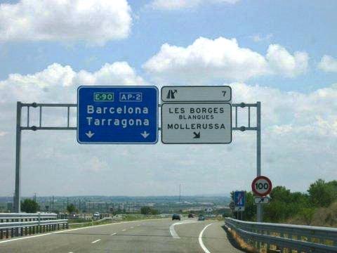
Add exit tabs similar to the type found in Spain and the made-over sign will appear like this:

Of course, with this one the state engineers may have to order the sign bridge replaced with a new, stouter one. In which case, one can have a fifteen-foot high sign with the arrows down at the bottom and away from the town names, and include the hours and days of the week when carpool are required.
 |
| 237 South Bay Freeway looking East at McCarthy Blvd overhead sign bridge. |
Another misleading aspect of this sign is that the access lane to the 880 Express Lane is indicated to be in the left-hand breakdown lane. That's not the case either.
Plus, there's a tiny sign announcing that the Express Lane is only for 2-occupant -or-more carpools, except toll tag holders can use the lane regardless of how few people the vehicle carries. It's very easy to miss.
What is needed is a sign of the same size with only as many arrows as there are lanes (four, with a fith up ahead peeling off to McCarthy Blvd). It has to be the same size because of earthquakes -- a bigger sign may cause the sign bridge to tip over onto the traffic, or the truss-beam to detach from the pillars and fall onto the roadway, cars and all.
So here's an idea to clean up the sign:

Now we have almost* ALL the information on one sign, 60 feet wide by ten feet tall, same as the existing sign, with everything legible and in their proper place and only FOUR arrows pointing up, one for each travel lane. The right-hand arrow at the inside lane splits to indicate the upcoming exit and the "ONLY" next to it indicates either 237 Calaveras Blvd or McCarthy Blvd only.
* Except carpool required hours and days of the week.
Add exit tabs similar to the type found in Spain and the made-over sign will appear like this:

Of course, with this one the state engineers may have to order the sign bridge replaced with a new, stouter one. In which case, one can have a fifteen-foot high sign with the arrows down at the bottom and away from the town names, and include the hours and days of the week when carpool are required.
An Idea for an Advanced Notice Exit Sign 2
I told you all that I'd do something about those Sword of Damocles arrows. You know, the kind pointing down just so that they look like they could fall off any minute and land on your car, causing vehicle damage and even personal injury or death (if it pierces the roof or if the convertible top is down).
So I have a sign spanning the full width of the southbound tollway at this place:
And this is how I would have it for the present Florida's Turnpike Extension number (SR 821) with my suggested design for a tollway in Florida:

The purple denotes the main road's present TAGS ONLY / TOLL-BY-PLATE status. I'm going by Route Number and not the goofy fact that it's the Florida Turnpike Extension from original mile marker 4 of the Turnpike itself and not the original endpoint like Massachusetts did for the Mass. Pike.
Note the arrows underneath and divided by a line from the main board like in Australia.
Now here what it would like if it were an interstate:

I picked I-991 for two reasons: first, the existing Turnpike mainline is SR 91 which would become I-91 South in my scheme; second, if you look at a map you'll find most of the state highways in Miami-Dade County are in the 900s series.
Feel free to comment!
So I have a sign spanning the full width of the southbound tollway at this place:
 |
| Source: aaroads.org |
And this is how I would have it for the present Florida's Turnpike Extension number (SR 821) with my suggested design for a tollway in Florida:

The purple denotes the main road's present TAGS ONLY / TOLL-BY-PLATE status. I'm going by Route Number and not the goofy fact that it's the Florida Turnpike Extension from original mile marker 4 of the Turnpike itself and not the original endpoint like Massachusetts did for the Mass. Pike.
Note the arrows underneath and divided by a line from the main board like in Australia.
Now here what it would like if it were an interstate:

I picked I-991 for two reasons: first, the existing Turnpike mainline is SR 91 which would become I-91 South in my scheme; second, if you look at a map you'll find most of the state highways in Miami-Dade County are in the 900s series.
Feel free to comment!
Friday, June 3, 2016
An Idea for an Advanced Notice Exit Sign
This is for the Homestead Extension of Florida's Turnpike at the Richmond Heights exit going south. Here's the existing:
So I would like to suggest something up like this:

First, I changed the standard USA exit tab with a pictographic one like the kind they have in Spain. I put the street names met by the exit at the upper right-hand side like they do in Australia. The Route Marker is similar to those from some of my suggested route markers for Florida. And I added the name of the nearest established neighborhood and the name of the nearby public facility / tourist attraction.
All it's missing are those Sword of Damocles arrows. More on that later.
 |
| Source: AARoads.com |

First, I changed the standard USA exit tab with a pictographic one like the kind they have in Spain. I put the street names met by the exit at the upper right-hand side like they do in Australia. The Route Marker is similar to those from some of my suggested route markers for Florida. And I added the name of the nearest established neighborhood and the name of the nearby public facility / tourist attraction.
All it's missing are those Sword of Damocles arrows. More on that later.
Subscribe to:
Posts (Atom)